Photo by Icebreaker Mackinaw Maritime Museum
A self-guided walking tour through Mackinaw City includes more than 50 historical markers. The three-mile pathway winds through Mackinaw City and includes information along the way about the area’s history as the Crossroads of the Great Lakes.
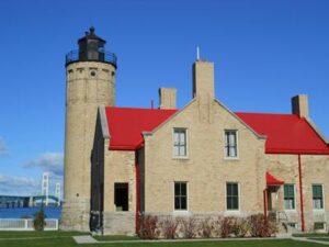
The numbered trail begins at the corner of Central Avenue and Huron Street then continues south on Huron Street to the State Dock, north along the waterfront to Old Mackinac Point Historic Lighthouse and Colonial Michilimackinac. The trail ends along Nicolet Street and Central Avenue.pathway2
Along the Historical Pathway, visitors can also learn more about the Mackinaw City area history using cell phones to access the Audio Tour. Signs along the route include a telephone number to call. The audio tour also can be used at the Icebreaker Mackinaw, Headlands, McGulpin Point Lighthouse, and the Historic Village.


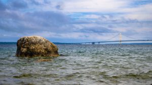
The Mackinac Bridge is the 10th largest suspension bridge (over water) in the world and connects Michigan’s Upper and Lower Peninsula.

With Lake Michigan on one side and Lake Huron on the other side, Mackinaw City is a true Great Lake’s spot with lots of things to do!

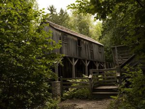
Historic Mill Creek has 625 acres along Lake Huron, 3.5 miles of hiking trails, a reconstructed saw mill, mill dam, and more.

McGulpin Rock, near Mackinaw City, has been used as a navigational tool by explorers and mariners since before the Pilgrims landed.

The history of the fur trade in Northern Michigan is captured at Colonial Michilimackinac in Mackinaw City.

Built during World War II to haul heavy materials during the winter, the Icebreaker Mackinaw was in service for 62 years then became a museum.